Old Ordnance Survey Maps of Ayrshire

  • These detailed maps normally cover an area of about one and a half miles by one mile. Each map includes an introduction.
  • They are available through our On-line Mapshop

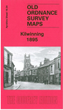
  • Here are the details of maps for Kilwinning:

  • Ayrshire Sheet 16.04 Kilwinning 1895 - published 2010; intro by Gilbert Bell. ISBN.978-1-84784-360-9

    This detailed map covers the Ayrshire town of Kilwinning, with coverage extending eastward to Corsehill, south to the Eglinton Iron Works.

    Features include the town centre with The Green, worsted mill, church, cemetery, Main Street showing every house and building, Byres, Townhead, Corsehill, Kenneth's Castle etc. Several railways are shown including the GSWR line with station, branches, Dubbs Junction, Blacklands Junction, Doura Branch; Lanarkshire & Ayrshire Railway with station, branches; Eglinton Iron Works, Eglinton Fire Clay Works, Eglinton Engine Works, football ground etc.


  • Follow this link for a complete list of our Ayrshire maps.
  • You can order maps direct from our On-line Mapshop. For other information and prices, and other areas, go to The Index Page.
  • Maps in the Godfrey Edition are taken from the 25 inch to the mile map and reduced to about 15 inches to the mile. For a full list of maps for Scotland, return to the Scotland page.
    The Godfrey Edition / sales@alangodfreymaps.co.uk / 15 November 2016