        |
Information

New Products

Dh 7.14b Washington 1914
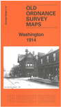
Detailed map of Washington; Durham sheet 7.14
Introduction by John Griffiths
Double-sided map covers Washington Colliery, Blue House, New Washington, The Green, Dame Margarets Home Holy Trinity Church and St Mary's RC Church.
find out more
Dh 28.09 Wheatley Hill & Thornley 1939
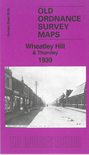
Detailed map of Wheatley Hill & Thornley; Durham sheet 28.09
Introduction by David & Helene Farn
Covers Thornley Colliery, The Farm, Wheatley Hill Cemetery, St Bartholomews Church, Thornley House, Gore Hall and Thornlaw North and South.
find out more
Y 259.04 Slaithwaite 1904
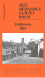
Detailed map of Slaithwaite; Yorkshire sheet 259.04
Introduction by Martin Handley
Covers St James's Church, Town Hall, Railway Station, Crimble Mills, Merry Dale Bridge, Worts Hill, Cricket Ground and Clough House.
find out more
Y 260.01 Linthwaite 1905
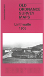
Detailed map of Linthwaite; Yorkshire sheet 260.01
Historical introduction by Martin Handley
Covers Royd House, Hoyle House, Crimble, Railway Station, Christ Church, Upper & Lower Wellhouse, and Crimble Clough.
find out more
Subscription: next 10 maps of Tyneside

Subscription to next 10 Tyneside maps
You will receive the next 10 Tyneside maps as they are published. Excellent value at £30.00 post free (until mid October, £35.00 thereafter)
Commences December
UK ADDRESSES ONLY
find out more
LS 7.70 Limehouse North 1870-94
Large scale plan of Limehouse North; London 7.70
Introduction by Pamela Taylor
Covers Salmon's Lane Lock, St Anne's Church, Brittania Bridge, Burdett Hall, Victoria Park Approach Bridge, People's Hall and Howrah House.
find out more
LS 7.80 Limehouse (South) 1868-94
Large scale plan of Limehouse South; London 7.80
Introduction by Pamela Taylor
Highly detailed map, covering Stepney Union, Bridge Yard Dry Dock, West India Dock Station, Brunswick Chapel, Limehouse Station, Limekiln Dock.
find out more
Prls 12 Preston Park Road & St Ignatius 1847-57
Preston sheet 12
Original 5 foot plan reduced to a yard to the mile
Introduction by Alan Godfrey
Covers St Paul's Church, Sisters of Charity Convent, House of Recovery, Old Station, Hanover Street Foundry, House of Correction and Court House.
find out more
Prls 17 Preston Town Centre 1847
Preston sheet 17
Original 5 foot plan reduced to a yard to the mile
Introduction by Alan Godfrey
Covers St James's Church, St John's Church, Market Place, Town Hall, Winckley Club House, Temperence Hall.
find out more