New Products
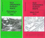
Special Offer: St 68.02b & 68.02c Mesty Croft 1902 & 1913
Mesty Croft 1902 & 1913
Each with an introduction
Special offer for the pair of maps
find out more
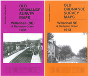
Special Offer: St 63.09b & 63.09c Willenhall (SE) & Darlaston Green 1901 & 1913
Willenhall (SE) & Darlaston Green 1901 & 1913
Each with an introduction
Special offer for the pair of maps
find out more
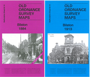
Special Offer: St 62.16a (Coloured) & 62.16c Bilston 1884 & 1913
Bilston 1884 & 1913
Each with an introduction
Special Offer for the pair of maps
find out more
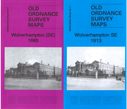
Special Offer: St 62.11a & 62.11c Wolverhampton (SE) 1885 & 1913
Wolverhamton (SE) 1885 & 1913
Each with an introduction
Special offer for the pair of maps
find out more
Special Offer: St 18.06a & 18.06b Fenton 1922 & 1937
Fenton 1922 & 1937
Each with an introduction
Special Offer for the pair of maps.
find out more
Special Offer: St 62.07a & St 62.07c Wolverhampton (NE) 1885 & 1913
Wolverhampton (NE) 1885 & 1913
Each with an introduction
Special offer for the pair of maps
find out more
La 96.09b Prestwich 1932
Detailed map of Prestwich; Lancs sheet 96.09
Introduction by Alan Godfrey
Covers St Mary's Park, Railway Station, Prestwich Park, County Mental Hospital, St Mary's Church and Cricket Ground.
find out more
La 79.04 Irwell Vale & Lumb 1908
Detailed map of Irwell Vale & Lumb; Lancashire sheet 79.04
Introduction by Nigel Jepson
Covers Hardsough, Ewood Bridge & Edenfield Station, Sunny Bank, Kenyon Clough Farm and Workmens Club.
find out more
Wk 19.12 Solihull 1902
Detailed map of Solihull; Warwickshire Sheet 19.12
Introduction by Barrie Trinder
Covers Malvern Hall, St Alphege's Church, Solihull Union Workhouse, Solihull Station, Lode Heath and George Hotel.
find out more
M 19 Miles Platting 1848
Manchester & Salford sheet 19
Original 5 foot plan reduced to a yard to the mile
Area around Oldham Road, Edward Street, New Allen Street, Collyhurst Lane
Historical introduction by Chris Makepeace
find out more
Subscription: next 10 London Large Scale maps
Subscription to next 10 Maps of London
You will receive the next 10 maps of London as they are published. Excellent value at £25.00 until 1st November (£30 thereafter)
Commences January
UK ADDRESSES ONLY
find out more
Ke 19.08 Central Gillingham 1932
Detailed map of Central Gillingham; Kent sheet 19.08
Historical introduction by Pamela Taylor
Covers Gillingham Park, Secondary School, Woodlands Senior School, St Luke's Church, Railway Station, Cemetery and St Mark's Vicarage.
find out more
Ke 19.11 Chatham (South) & Fort Luton 1932
Detailed map of Chatham (South); Kent sheet 19.11
Historical introduction by Pamela Taylor
Covers Chatham Extra Cemetery, Fort Luton, Holcombe Juniour Technical School, Medway Cottage Homes, Football Ground, Medway Hospital and St William's Hospital.
find out more
Y 7.12 Marske-by-the-Sea 1927
Detailed map of Marske-by-the-Sea; Yorkshire sheet 7.12
Introduction by Alan Godfrey
Covers Marsk Hall, St Mark's Church, Hummers Hill Farm, Erimus Hutments, The Aerodrome, St Germain's Church and Cliff House.
find out more
Y 7.03b Redcar 1927
Detailed map of Redcar; Yorkshire sheet 7.03
Introduction by Alan Godfrey
Covers Zetland Park, West Dyke, Railway Station, St Peter's Church, Cemetery, Borough Park, Grammar School and Pier.
find out more
Dv 124.09 Plymouth (Oreston & Cattedown) 1912
Detailed map of Plymouth (Oreston & Cattedown); Devon sheet 124.09
Introduction by Richard Oliver
Covers Pomphlett, Plymouth Chemical Works, Turnchapel, Downhorn Farm, Bedford Quarry, Church of the Good Shepherd, Prince Rock and Laira Bridge.
find out more
Dv 124.05 Plymouth (Laira) 1912
Detailed map of Plymouth (Laira); Devon sheet 124.05
Introduction by Richard Oliver
Covers Laira Junction, Saltram Farm, Borough Hospital, Friary Junction, Mount Gold, Laira Hall and St Simon's Church.
find out more
Pls 4 Pontefract Castle 1849-89
Large Scale Plan Pontefract Sheet 4
Introduction by Alan Godfrey
Covers Castle precincts, Market Place, St Giles' Church, All Saint's Church, Micklegate, Pontefract Workhouse and Barbican Row.
find out more
Y 202.07 Horsforth (North) 1906
Detailed map of Horsfoth (North); Yorkshire sheet 202.07
Introduction by Martin Handley
Covers Horsforth Station, St Margaret's Church, Cookridge Mills, Queens Arms Public House, Westbrook House, North High Farm, Football Ground and Wetstone Farm.
find out more
LS 8.22 Stratford (South) 1867-93
Large Scale Plan of Stratford (South); London sheet 8.22
Reduced from the original 5' to a mile plan
Introduction by Tony Kirby
Covers West Ham Gas Works, Christ Church, Stratford Bridge, Channel Sea Bridge, Railway Station and the London Spinning Mills.
find out more


