
 Here are the details of maps for Sheffield Heeley:

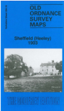
This detailed map covers the southern part of Sheffield around Heeley. Coverage stretches from Valley Road eastward to Hurl Field, and from Prospect Road southward to Norton Lees and St Paul's church. The NW quarter of the map is built up and features here include Christ Church, Heeley Rolling Mills, Ball Inn Recreation Ground and numerous streets of terraced houses, shown in good detail. South and east of this the area was largely rural and features include Thorpe House, Lees Hall, Newfield Green, Brownell's Plantation. We include street directories for Gleadless Road, Meersbrook Park Road, Norton Lees Lane, Richards Road, Upper Valley Road, Well Road on the reverse.
The map links up with Sheets 294.12 Sheffield Park to the north, 294.15 Nether Edge to the west.