
 Here are the details of maps for Eastwood:

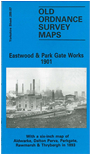
This detailed map covers an area on the northern fringe of Rotherham, stretching from Eastwood Vale nortward to Park Gate Works, and from Eastwood View westward to Barbot Hall. The Midland Railway and GCR Sheffield & Mexborough line both cross the map, which includes Rotherham Road and Parkgate & Rawmarsh stations. Other features on a largely industrial map include Car House Colliery, British Wagon Works, Northfield Chemical Works, the southern half of Aldwarke Main Colliery with coke ovens, Sheffield & South Yorkshire Navigation, Basic Slag Manure Works, Park Gate Steel Works, and several little communities along Rotherham Road sandwiched between the works.
This map does not include an introduction but on the reverse is the Six Inches to the Mile map for 1895 covering a larger area, including Rawmarsh, Eastwood, Aldwarke, Dalton Parva and Thrybergh.
The map links up with Yorkshire Sheet 289.03 Rawmarsh to the north and 289.11 Rotherham to the south.