
 Here are the details of maps for Stocksbridge:

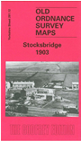
This detailed map covers the steel village of Stocksbridge. This had grown around the steelworks developed in the mid 19th century, and had a population of 6,566 by 1901. Our map covers most of the village, with features including Stocksbridge Iron & Steel Works, St Matthias church, gas works, Manchester Road, Stocksbridge Railway, Sheffield Corporation Railway, Stocksbridge Hall, Pot House Pipe Works, Pea Royd Hill, Berton under Edge, Hunshelf Bank, Hawthorn Brook. On the reverse we include directories of Stocksbridge for 1905 and 1916.
Follow this link for a complete list of our Barnsley area maps; here for the Sheffield maps; or here for the whole Yorkshire series.
Maps in the Godfrey Edition are taken from the 25 inch to the mile map and reduced to about 15 inches to the mile.
Alan Godfrey Maps, Prospect Business Park, Leadgate, Consett, Co Durham, DH8 7PW / sales@alangodfreymaps.co.uk / 28 January 2018