We have very good coverage for Kirklees Metropolitan Borough, which was formed in 1974 from the Dewsbury and Huddersfield County Boroughs, Batley and Spenborough Municipal Boroughs, and Colne Valley, Denby Dale, Heckmondwike, Holmfirth, Kirkburton, Meltham and Mirfield Urban Districts.
The following titles are all taken from the OS 25" maps and reduced to a scale of approximately 14 inches to the mile. Each covers an area of a mile and a half by one mile, and includes an introduction. Click on the links below for further details. All maps are available from our On-line Mapshop.
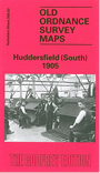 Here are the details of maps for Lockwood & Huddersfield (South):

This detailed map covers much of south Huddersfield, including parts of Almondbury parish. Coverage stretches from Dungeon Wood eastward to Longley, and from Primrose Hill southward to Hall Bower. The hamlet of Newsome with St John's church is near the centre of the map. Features and areas include Broadfield Mills, Prospect Iron Works, Moor End, Lockwood, Lockwood Brewery, Taylor Hill, River Holme, Laith Croft, Bluebell Hill, Newsome Top, Close Hill, Newsome Cross, Primrose Hill, Ashing Hirst, Tunnacliffe Hill, Squirrel Ditch, Longley Green, Hall Bower, Castle Hill Top (in SE corner of map), Stile Common, Yew Green (in NW corner), Jack Royd. The LYR railway runs through the map incl Lockwood station and (at foot of map) Berry Brow station; also incl Meltham Junction and Lockwood Viaduct. We include street directory entries on the reverse, incl Albert Street, Bentley Street, Lockwood Road, Taylor Hill Road.
The map links up with sheet 246.15 Central Huddersfield to the north.