
 Here are the details of maps for Horbury:

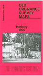
This detailed map covers Horbury and Horbury Bridge, just west of Wakefield. The small town of Horbury is on the right hand side of the map, and features here include St Peter's church, House of Mercy, Hall Cliffe, Peel Mill, High Street, tramway, Tithe Barn Street, The Crofts, Addingford Hill, Addingford Mills. Coverage of the map then continues west to include Horbury Bridge, with St John's church, Navigation Mill, Horbury Bridge Mill, Old Mill, Cockhill Mill, Horbury Dye Works, Ford Mill. The River Calder and Calder & Hebble New Cut run through the map. The Lancashire & Yorkshire Railway crosses the map, with Horbury & Ossett station. A directory of Horbury is included.
The map links up with Sheets 248.05 Ossett to the north and 248.10 Horbury Jct to the east.