We have very good coverage for Kirklees Metropolitan Borough, which was formed in 1974 from the Dewsbury and Huddersfield County Boroughs, Batley and Spenborough Municipal Boroughs, and Colne Valley, Denby Dale, Heckmondwike, Holmfirth, Kirkburton, Meltham and Mirfield Urban Districts.
The following titles are all taken from the OS 25" maps and reduced to a scale of approximately 14 inches to the mile. Each covers an area of a mile and a half by one mile, and includes an introduction. Click on the links below for further details. All maps are available from our On-line Mapshop.
 Here are the details of maps for Mirfield:

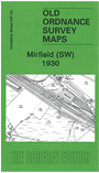
This detailed map covers the western part of Mirfield, with coverage stretching from St Paul's church westward to Heaton Lodge, and from Frances Street southward to Hopton Brow. The Lower Hopton, Littlemoor, New Scarbro', Snake Hill, and Stocks Bank areas are included. Features include Ledgard Bridge, Ledgard Bridge Mills, Butt End Mill, Fold Head Mill, Clive Mills, Wellington Mill, Bankfield Mills, railway lines with engine depot, Battyeford station, Midland Huddersfield Branch, Bog Hall, Heaton Hall, Tib Netherend Wood, Boyfe Hall, Ings Grove, River Calder, Battye Ford Lock with boatbuilding yard, Knowl. On the reverse we include a 1927 Commercial Directory.
The map links up with Sheets 247.01Mirfield NW to the north and 247.06 Mirfield to the east.