
 Here are the details of the map for Ripponden:

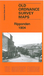
This detailed map covers the village of Ripponden, with coverage southward to Rishworth station and eastward to Christ Church, Barkisland.
Features include railway with Ripponden and Rishworth stations, Slithero House, Slithero Mills, Commercial Mills, Lower Dyson Lane Mill, Pretoria Bridge, Hollins, Zion Chapel, Small Lees Mill, Height Green, Fox Stones, Ripponden Mills, Chapel Field Mill, Brig Royd, St Bartholomew's church, Bridge Inn, Hanging Stones Wood, Barkisland Cross, Hazelgreave Hill, Slack, Christ Church, Heald Wall Nook etc. On the reverse we include 1889 directories for Ripponden and Rishworth, with a 1914 timetable for the railway branch.
You can order maps direct from our On-line Mapshop. For other information and prices, and other areas, go to The Index Page.
Maps in the Godfrey Edition are taken from the 25 inch to the mile map and reduced to about 15 inches to the mile. Follow this link for a complete list of our Calderdale maps; or here for the whole Yorkshire series.
Alan Godfrey Maps, Prospect Business Park, Leadgate, Consett, Co Durham, DH8 7PW / sales@alangodfreymaps.co.uk / 20 Sept 2016