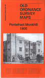
Yorks 234.16 Pontefract Monkhill 1905 - published 2015; intro by Alan Godfrey. ISBN.978-1-84784-932-8 
This detailed map is double-sided for maximum coverage. It covers the northern part of Pontefract.
Features include railways with Pontefract Monkhill station, eastern part of racecourse, Prince of Wales Collieries, Lady Balk, Old Hall,
Fern Hill, St Thomas Mill, Grange Liquorice Refinery, Pomfret Mills, St John's Priory site, New Town, Spittal Hardwick, etc.
The map links up with sheet 249.04 Pontefract to the south.
You can order maps direct from our On-line Mapshop.
For other information and prices, and other areas, go to The Index Page.
Maps in the Godfrey Edition are taken from the 25 inch to the mile map and reduced to about 15 inches to the mile.
Follow this link for a complete list of our Wakefield maps; or here for the
whole Yorkshire series.
Alan Godfrey Maps, Prospect Business Park, Leadgate, Consett, Co Durham, DH8 7PW /
sales@alangodfreymaps.co.uk / 24 January 2018

 Here are the details of maps for north Pontefract: