
 Here are the details of maps for Clayton Heights:

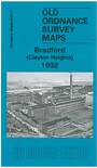
This detailed map covers the area around Clayton Heights, west of Bradford, with coverage stretching from the Black Dyke Mills (SW corner of map) eastward to Horton Bank Reservoir and northward to Oakleigh Road.
Features include part of Black Dyke Mills, Queensbury station with famous railway triangle, Poor Law Institution, Brayshaw Reservoir, Horton Bank Reservoir, Old Dolphin area, tramway, Westwood Institution, Scarlet Heights area, Sheep Hill, Lane End area etc. On the reverse we include a commercial directory for Queensbury, plus street directory entries for Clayton Lane, Highgate Road, Oakleigh Road and Pasture Lane.
The map links up with sheet 216.06 Clayton to the north, 216.09 Queensbury to the west, 216.11 Bradford (Great Horton) to the east.