Old Ordnance Survey Maps of Leeds

  • These detailed maps normally cover an area of about one and a half miles by one mile. Each map includes an introduction.
  • They are available through our On-line Mapshop

  • Here are the details of maps for Yeadon:

  • Yorkshire Sheet 202.02 Yeadon 1906 - published 2002; intro by Suzanne Grahame. ISBN.978-1-84151-460-4

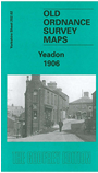
    This detailed map covers the town of Yeadon, a few miles north of Leeds. Yeadon itself is in the top half of the map and coverage extends south to the northern tip of Rawdon, around Little Moor, Quakers' Lane, Benton Park Farm and Canada. Features on the map include Yeadon town centre - all shown in detail, with individal houses neatly delineated - railway branch with station, Green Lane Mill, Nether Yeadon, Henshaw, Yeadon & Guiseley Gas Works, Leafield Mills, Kirk Lane Mills, High Henshaw, Westfield Mill, Manor Mills, Hawthorn Terrace, St Andrew's church, Town Hall Square, Albert Mill, Waterside Dye Works, Moorfield Mills. On the reverse we include a directory of Yeadon in 1889.

    The map links up with sheet 202.06 Rawdon to the south.


  • Follow this link for a complete list of our Bradford or Leeds area maps; or here for the whole Yorkshire series. You can order maps direct from our On-line Mapshop. For other information and prices, and other areas, go to The Index Page.
  • Most maps in the Godfrey Edition are taken from the 25 inch to the mile map and reduced to about 15 inches to the mile.
    For a full list of maps for England, return to the England page.
    Alan Godfrey Maps, Prospect Business Park, Leadgate, Consett, Co Durham, DH8 7PW / sales@alangodfreymaps.co.uk / 8th August 2017