Old Ordnance Survey Maps of Yorkshire

  • These detailed maps normally cover an area of about one and a half miles by one mile. Each map includes an introduction.
  • They are available through our On-line Mapshop

  • Here are the details of maps for Leyburn:

  • Yorkshire Sheet 68.06 Leyburn 1911 - published 2004; intro by Alan Godfrey. ISBN.978-1-84151-663-9

    This detailed map covers the small Wensleydale town of Leyburn. Features on the map include the town centre, with Market Place, Leyburn Hall, Grove Square, Thornburgh House, St Matthew's church, Workhouse, Town Hall, St Mary's Mount, railway and station. Coverage extends eastward to Maythorn Farm, westward to Chapel Flatts and Leyburn Shawl Plantation, with railway incline to Leyburn Quarries. On the reverse we include a directory of Leyburn in 1905.

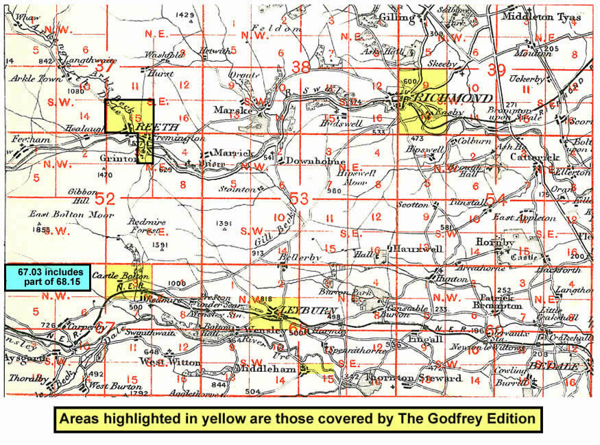
    And here is an index map showing the areas covered.


  • You can order maps direct from our On-line Mapshop. For other information and prices, and other areas, go to The Index Page.
  • Maps in the Godfrey Edition are taken from the 25 inch to the mile map and reduced to about 15 inches to the mile. Follow this link for a complete list of our North Yorkshire maps; or here for the whole Yorkshire series.
    Alan Godfrey Maps, Prospect Business Park, Leadgate, Consett, Co Durham, DH8 7PW / sales@alangodfreymaps.co.uk / 25 January 2018