 Here are the details of maps for Eston:

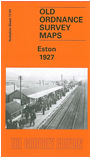
This detailed map covers the small town of Eston, with coverage extending eastward to Eston Nab, Eston Beacon and Lackenby Bank. The town in 1927 was very small and includes Old Eston, South Eston and California. Features include the station, Sheep Beck Bridge, Christ Church, High Street, Jubilee Road, hospital. The various mineral lines are of especial interest and here include Eston Mines Sidings, Trustee Incline to Trustee Drift Level, Old Incline to Old Bank Drift Level, New Incline and tramway towards Lazenby Bank. Eston Bank with the site of Eston ironstone mines - the reason for the town's growth - is in the centre of the map. We include a 1905 directory of Eston on the reverse to complete the historical portrait.
The map links up with sheet 16.04 Normanby to the west.