
 Here are the details of maps for Wivenhoe:

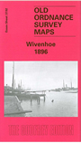
This detailed map covers the riverside town of Wivenhoe, just south of Colchester. The map includes most of the small, compact town, including its railway station, St Mary's church, Wivenhoe Hall, shipbuilding yards, Station Hotel, wharf. Across the River Colne are gravel pits and Fingringhoe Quay. To the north is Wivenhoe Mill and cemetery. A directory of Wivenhoe is included, plus a railway timetable for the local lines in 1915.
Maps in the Godfrey Edition are taken from the 25 inch to the mile map and reduced to about 15 inches to the mile. For a full list of maps for England, return to the England page.
Alan Godfrey Maps, Prospect Business Park, Leadgate, Consett, Co Durham, DH8 7PW / sales@alangodfreymaps.co.uk / 25 November 2017