Old Ordnance Survey Maps of Wiltshire

  • These detailed maps normally cover an area of about one and a half miles by one mile. Each map includes an introduction.
  • They are available through our On-line Mapshop

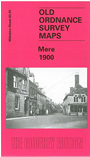
  • Here are the details of maps for Mere:

  • Wiltshire Sheet 63.05 Mere 1900 - published 2000; intro by Alan Godfrey. ISBN.978-1-84151-197-9

    This detailed map is double-sided for maximum coverage and covers most of the town area. Coverage also extends westward to Zeals House.

    Features on the main map include St Michael's church, Chantry House, Castle Hill, Mere Workhouse, Market Place, Friends Meeting House, cemetery, Rook Street, Dead Maid Quarry, Quarry Cottage, Lower Zeals, Zeals House, Manor Farm.

    On the reverse we include part of adjacent sheet 63.06 extending coverage east to include Water Street area, Edge Bridge, Milk Factory, Mere Mill, Silk Factory (Disused), Clay Knapp, Holwell. An 1899 directory is also included.

    A map of the neighbouring village of Zeals is included on the reverse of One Inch sheet Wincanton, Mere & District.


  • Follow this link for a complete list of our Wiltshire Series or Swindon maps; or here for all maps in South West England.
  • You can order maps direct from our On-line Mapshop. For other information and prices, and other areas, go to The Index Page.
  • Most maps in the Godfrey Edition are taken from the 25 inch to the mile map and reduced to about 15 inches to the mile. For a full list of maps for England, return to the England page.
    The Godfrey Edition / sales@alangodfreymaps.co.uk / 12 January 2018