
 Here are the details of maps for Corsham:

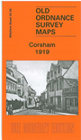
This detailed map shows the small town of Corsham and the hamlets of Lower Pickwick, Cross Keys, Pound Pill and Prospect Place surrounded by large areas of fields and Corsham Park. Features on the map include the town centre, Corsham Court, Lower Pickwick, St Bartholomew's church; coverage stretches north to Cross Keys. On the reverse we include part of adjacent map 25.12 extending coverage south, and this includes the Great Western Railway line and station, as well as some of the tramways that lead to the quarries. The sheet also includes a brief history of Corsham and the surrounding area, that describes the origins of its settlement, the Roman influence, a review of the manor houses and halls, and its industrial and transport history to the time of the map.