 Here are the details of maps for Athlone (West):

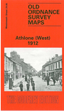
This very detailed map covers the western half of Athlone, with coverage stretching from the Town Bridge westward to Bellaugh and the county boundary. Note that the Roscommon area to the west is left blank.
Features include Shannon Bridge, Town Bridge, Barracks, Infantry Square, railway with Midland Great Western station, engine shed, junction with Mayo Branch, Ranelagh School, Fort Hill, Gallows Hill, Grand Canal Store, Father Mathew Hall, Shannon Saw Mills, Woollen factories, Union Workhouse, St Kieran's Terrace, Connaught Street area, Cavalry Square, Bellaugh, Bogganfin area, Monksland area etc. On the reverse we include extracts from the 1914 rate books for Connaught Street, King Street and Queen Street.
The map links up with sheet 29.06 Athlone (East) to the east.