 Here are the details of maps for Washington:

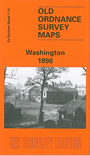
This detailed map of the original Washington is double-sided to give maximum coverage. The main map covers the area west of the village, a semi-rural landscape which includes Old Washington, the Washington Wagonway, Brandy Row, Washington Colliery. Wagonman's Row is at the top of the map. The map extends west across Washington Moor to High Washington, Havannah Terrace and the terrace known as New York. On the reverse we include a large part of adjacent sheet 7.15 and this includes the actual village of Washington, including Old Hall, Holy Trinity church, Dame Margaret's Home, RC church. The hamlet known as New Washington is at the top of the map. At the extreme right is a section of the Leamside & Ferryhill railway line with Usworth station.
The map links up with sheet 7.13 Birtley (North) to the west and with 13.03 Cox Green to the SE.