
 Here are the details of maps for Theydon Bois:

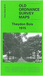
This detailed map covers the village of Thedon Bois, spread out from its station on the GER Ongar line. The map covers an area of one and a half miles by one mile, and includes Theydon Green, the station, Thrifts Hall, nurseries, St Mary's church, Coppice Row, Manor Villas. A portion of Epping Forest is in the NW corner. Directories of the village for 1895 and 1922 are included.
Maps in the Godfrey Edition are taken from the 25 inch to the mile map and reduced to about 15 inches to the mile. For a full list of maps for England, return to the England page.
Alan Godfrey Maps, Prospect Business Park, Leadgate, Consett, Co Durham, DH8 7PW / sales@alangodfreymaps.co.uk / 25 November 2017