Old Ordnance Survey Maps of County Tyrone

  • These detailed maps normally cover an area of about one and a half miles by one mile. They are available through our On-line Mapshop

  • Here are the details of maps for Strabane:

  • Co Tyrone Town Plans Strabane 1905 - published 1987; reprinted with minor amendments 2019. ISBN 978-1-78721-248-0

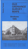
    This detailed map includes the three Town Plans of Strabane, here reduced in scale to 24 inches to the mile.

    Map 1 shows the northern part of the town, including railway station, Canal Basin, Abercorn Square, Butter Market. Map 2 has Castle Street, Castle Place, Christ Church, Strabane Bridge, Bridge End. Map 3 (on the reverse) has the eastern part of the town around Townsend Street, incl RC church and Convent. A directory of Strabane is also included.


  • Follow this link for a complete list of our Co Tyrone maps. On-line Mapshop. For other information and prices, and other areas, go to The Index Page.
  • Maps in the Godfrey Edition are taken from the 25 inch to the mile map and reduced to about 15 inches to the mile. For a full list of maps for Ireland, return to the Ireland page.
    The Godfrey Edition / sales@alangodfreymaps.co.uk / 12 September 2019