Old Ordnance Survey Maps of Staffordshire
These detailed maps normally cover an area of about one and a half miles by one mile. Each map includes an introduction.
They are available through our On-line Mapshop

 Here are the details of maps for Willenhall & Darlaston Green:
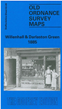
Staffordshire 63.09a Willenhall & Darlaston Green 1888 - published 1990; intro by Catherine Yates. ISBN.978-0-85054-301-8  Staffordshire 63.09b Willenhall (SE) & Darlaston Green 1901 - published 2009; intro by Malcolm Nixon. ISBN.978-1-84784-247-3
Staffordshire 63.09c Willenhall (SE) & Darlaston Green 1913 - published 2021; intro by Barrie Trinder. ISBN.978-1-78721-411-8
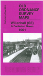
Staffordshire 63.09b Willenhall (SE) & Darlaston Green 1901 - published 2009; intro by Malcolm Nixon. ISBN.978-1-84784-247-3
Staffordshire 63.09c Willenhall (SE) & Darlaston Green 1913 - published 2021; intro by Barrie Trinder. ISBN.978-1-78721-411-8
We have published three versions of this map, showing how the area changed across the years. Each covers the same area, with coverage stretching from
Willenhall Lower Lichfield Street eastward to Darlaston & James Bridge station, and southward to Rough Hay House.
Features on the 1888 map include St Giles Church Willenhall, Chapel Green, Albion Works, Shepwell Green, New Priestfield Colliery, New Priestfield Iron Works, Birmingham Canal,
Victoria Iron Works, Crescent Iron Works, Rough Hay, Hopyard Colliery, Bentley Canal, LNWR Grand Junction line, Darlaston Green, Alma Works, Darlaston Green Furnaces, St George's church etc. Entries A-P from an 1865 Willenhall directory are included on the reverse.
The 1901 and 1913 maps cover the same area. Features in addition to those above include Willenhall Furnaces, canal now referred to as Walsall Canal, sewage farms, Vulcan Foundry, numerous works, but collieries mostly gone.
The map links up with sheets 63.05 Willenhall NE to the north, 62.12 Willenhall SW to the west, 63.10 Walsall SW to the east and 63.13 Darlaston to the south.
For a list of local maps, please go to the Walsall or West Midlands page.
You can order maps direct from our On-line Mapshop.
For other information and prices, and other areas, go to The Index Page.
Maps in the Godfrey Edition are taken from the 25 inch to the mile map and reduced to about 15 inches to the mile.
For a full list of maps for England, return to the England page.
Alan Godfrey Maps, Prospect Business Park, Leadgate, Consett, Co Durham, DH8 7PW /
sales@alangodfreymaps.co.uk / 5 March 2021


 Here are the details of maps for Willenhall & Darlaston Green: