Old Ordnance Survey Maps of Somerset

  • These detailed maps normally cover an area of about one and a half miles by one mile. Each map includes an introduction.
  • They are available through our On-line Mapshop

  • Here are the details of maps for Weston-super-Mare:

  • Somerset Sheet 9.16 Weston (East) 1902 - published 1999; introduction by Alan Godfrey. ISBN.978-1-84151-039-2

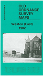
    This detailed map covers the eastern part of Weston-super-Mare, with coverage extending east and north to Baytree Farm and Home Farm in Milton. Features on the map include the GWR station, goods station, engine shed, St Saviour's church, Victoria Hall, cemetery, Manor Farm, Landemann Circus, Ashcombe, The Lodge, tramway and depot. The Weston Clevedon & Portishead Light Railway is shown between Weston and Milton Road. On the reverse we include a list of private residents, entries H-Y.

    The map links up with Sheet 9.15 Weston-super-Mare to the west.


  • Follow this link for a list of our maps for Somerset or here for a general list for the South West.
  • You can order maps direct from our On-line Mapshop. For other information and prices, and other areas, go to The Index Page.
  • Maps in the Godfrey Edition are taken from the 25 inch to the mile map and reduced to about 15 inches to the mile. For a full list of maps for England, return to the England page.
    Alan Godfrey Maps, Prospect Business Park, Leadgate, Consett, Co Durham, DH8 7PW / sales@alangodfreymaps.co.uk / 13 January 2018