Old Ordnance Survey Maps of Somerset

  • These detailed maps normally cover an area of about one and a half miles by one mile. Each map includes an introduction.
  • They are available through our On-line Mapshop

  • Here are the details of maps for Portishead (West):

  • Somerset Sheet 02.09 Portishead (West) 1930 - published 2007; introduction by Mike Bone. ISBN.978-1-84151-978-4

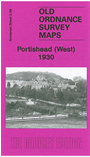
    This detailed map is one of three being published for Portishead. It covers the western part of the town, with coverage stretching from the High Street westward to the Nautical College, and from Beach Road southward to Wetlands Lane. Features on the map include West Hill, Dry Hill, Capenore Court, Greenfield Farm, Springfield Farm, St Peter's church, National Nautical School, Nore House, Black Nore Point Lighthouse, St Barnabas church, convent, Blade Road. On the reverse we include a commercial directory for Portishead.

    The map links up with Somerset Sheet 2.05 Portishead North to the north and Sheet 2.10 Portishead East to the east.


  • Follow this link for a list of our maps for Somerset or here for a general list for the South West.
  • You can order maps direct from our On-line Mapshop. For other information and prices, and other areas, go to The Index Page.
  • Maps in the Godfrey Edition are taken from the 25 inch to the mile map and reduced to about 15 inches to the mile. For a full list of maps for England, return to the England page.
    Alan Godfrey Maps, Prospect Business Park, Leadgate, Consett, Co Durham, DH8 7PW / sales@alangodfreymaps.co.uk / 13 January 2018