 Here are the details of maps for Sacriston:

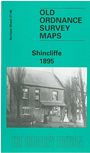
This very detailed map covers the village of Shincliffe, to the SE of Durham itself. The map is double-sided to provide maximum coverage. The main map covers the area from the River Wear eastward to Whitwell Grange and Sherburn Hospital (top right corner), and includes the village itself, Shincliffe Mill, Sherburnhouse Brick Works, the disused Old Durham and Shincliffe collieries, a small stretch of the Durham Elvet & Murton Branch railway, old coke ovens, the routes of old wagonways. On the reverse we extend coverage southward with part of adjacent sheet 26.10 and this includes Shincliffe Racecourse, Shincliffe Colliery village, Shincliffe station.
The map links up with Sheet 27.05 Durham City (South) to the west and 27.02 Durham City (East) to the north.