Old Ordnance Survey Maps of Stirlingshire

  • These detailed maps normally cover an area of about one and a half miles by one mile. Each map includes an introduction.
  • They are available through our On-line Mapshop

  • Here are the details of the map for north Stirling:

  • Stirlingshire Sheet 10.15 Stirling (North) 1896 - published 1984. ISBN.978-0-90755-473-8

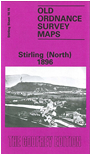
    This detailed map covers the northern part of Stirling, including the Poorhouse, Union Street Old Bridge and engine sheds. Other features include Raploch, River Forth, Mote Hill, Forthvale Mills, Gowan Hill, Coverage continues north to Wester Cornton and (in the NW corner) Craigforth Mill.

    On the reverse we include Six Inch map, sheet 10SE, which covers the wider north Stirling area, incl Causewayhead, Craigmill, Airthrey Castle, Cornton, the south part of Bridge of Allan, Powis House.

    The map links up with sheets 10.15 Stirling North top the north and 17.07 St Ninians to the south.


  • Follow this link for a list of our maps for Stirlingshire or here for a general list for Scotland.
  • You can order maps direct from our On-line Mapshop. For other information and prices, and other areas, go to The Index Page.
  • Maps in the Godfrey Edition are taken from the 25 inch to the mile map and reduced to about 15 inches to the mile. For a full list of maps for England, return to the England page.
    Alan Godfrey Maps, Prospect Business Park, Leadgate, Consett, Co Durham, DH8 7PW / sales@alangodfreymaps.co.uk / 21 November 2016