
 Here are the details of maps for Saffron Walden:

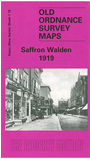
This detailed map shows the busy town of Saffron Walden. The town centre is included and the map also extends eastward to Millfield, the cemetery and the workhouse. Features include the GER railway and station, The Common, Friends School, part of Audley Park, High Street, Market Place, St Mary's church. Farmadine House, The Maze, castle remains. On the reverse we include directories of private residents in 1895 and 1914, plus a railway timetable in 1915.
Maps in the Godfrey Edition are taken from the 25 inch to the mile map and reduced to about 15 inches to the mile. For a full list of maps for England, return to the England page.
Alan Godfrey Maps, Prospect Business Park, Leadgate, Consett, Co Durham, DH8 7PW / sales@alangodfreymaps.co.uk / 25 November 2017