
 Here are the details of maps for Ryde:

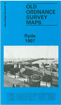
This detailed map covers the central and eastern parts of Ryde, with coverage stretching from Victoria Street and St Thomas Street eastward to Puckpool Point and Puckpool House, and southward to Well Street and St Johns Road station. Features include High Street, Union Street, Western Esplanade, Victoria Pier, much of Ryde Pier, Esplanade station, St John's Road station, Holy Trinity church, St Thomas Square, St John's Park, St Cecilia's Abbey, Appley Towers, Esplanade, St Clare. On the reverse we include a bonus map, a large extract from the 1862 First Edition '6 Inch to the Mile' map covering the area around Ryde, from Quarr Wood eastward to Puckpool Point, and including Oakfield, Swanmore, Haylands, Weeks and Binstead as well as Ryde itself.