Old Ordnance Survey Maps of Hampshire

  • These detailed maps normally cover an area of about one and a half miles by one mile. Each map includes an introduction.
  • They are available through our On-line Mapshop

  • Here are the details of maps for Ringwood:

  • Hampshire Sheet 70.11 Ringwood 1896 - published 2001; introduction by Jude James. ISBN 978-1-84151-324-9

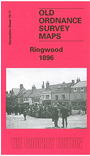
    This detailed map covers the small but important market town of Ringwood, whose population was 4,028 in 1891. Most of the town centre is included, and features here include Market Place, church, High Street, Manor House, Christchurch Street, Bickerley Common, Mansfield, Collar & Cuff Factory, station, cemetery. Coverage extends south to Westover Farm, north to Highfield, and west to Ashley and Watchmoor Wood; features to the west include the Workhouse. The map is notable for the many channels of the Avon, with substantial areas marked as 'liable to floods'. A good directory of Ringwood in 1899 is also included.


  • Follow this link for a complete list for Hampshire.
  • You can order maps direct from our On-line Mapshop. For other information and prices, and other areas, go to The Index Page.
  • Maps in the Godfrey Edition are taken from the 25 inch to the mile map and reduced to about 15 inches to the mile. For a full list of maps for England, return to the England page.
    Alan Godfrey Maps, Prospect Business Park, Leadgate, Consett, Co Durham, DH8 7PW / sales@alangodfreymaps.co.uk / 12 January 2018