
 Here are the details of maps for Ongar:

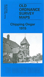
This detailed map covers the town of Chipping Ongar. Coverage stretches from the station southward to Marden Ash (the suburb which is actually in High Ongar parish). Features include High Street, with its many fine buildings, Sammes Cottages, and the castle site. Coverage continues westward to Greensted, with Greensted Hall and St Andrew's church, sometimes claimed as the oldest wooden building in Europe. We also include directories for Chipping Ongar, High Ongar and Greensted in 1895.
Maps in the Godfrey Edition are taken from the 25 inch to the mile map and reduced to about 15 inches to the mile. For a full list of maps for England, return to the England page.
Alan Godfrey Maps, Prospect Business Park, Leadgate, Consett, Co Durham, DH8 7PW / sales@alangodfreymaps.co.uk / 25 November 2017