
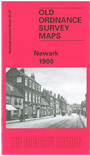
 Here are the details of maps for Newark:

This very detailed map covers the centre of Newark, and its southern and western outskirts. Coverage stretches from Queen's Road southward to Sconce Hills.
Features include Market Place, St Mary's church, chapels, part of Midland Railway with southern end of station, Castle remains, Flour Mill with railway connection, River Trent, Hospital, Town Hall, chapels, schools, St Catherine's Well, Farndon Field, malthouse, Trent Bridge, Town Wharf Grammar School, Chantry House, The Friary, Devon Bridge etc. On the reverse we include street directory entries for Balderton Gate, Carter Gate, Castle Gate, Kirk Gate, Market Place, Middle Gate.
The map links up with Notts sheet 35.04 Newark East to the east and 30.16 Newark North to the north.