
 Here are the details of maps for Melton Constable:

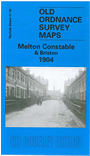
This detailed map covers the area from Melton Constable to Briston, with coverage stretching from Melton Constable station eastward to Hall Farm, Briston. Melton Constable, a village with just 118 people in 1881, became a railway 'town' when the Midland & Great Northern Joint Railway opened their works here; the population then rose to 1,157 by 1911. Our map shows that Locomotive Works (the full track layout is given) and the handful of streets that were built next to it for workers. Burgh Hall and the remains of St Mary's church are also shown. The map continues eastward and on the right side of the map is much of Briston, including Manor Farm, Horseshoe Common, All Saints church, Church Street. The directory describes Briston as a 'small town' but it appears more of a village here. We include directories for both Briston and Melton Constable, and the introduction by John Gough, an acknowledged expert on railway history, helps complete an excellent history of these two little town-villages.