Old Ordnance Survey Maps of Berkshire

  • These detailed maps normally cover an area of about one and a half miles by one mile. Each map includes an introduction.
  • They are available through our On-line Mapshop

  • Here are the details of maps for Newbury:

  • Berkshire Sheet 43.01 Newbury 1898 - published 2000; intro by Tony Higgott. ISBN.978-1-84151-207-5

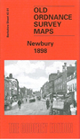
    This detailed map covers the centre and southern area of Newbury, concentrating on the area south of the River Kennet. Features include the Market Place, St Nicholas church, Kennet & Avon Canal, GWR railway and station, West Fields, Bartholomew Street, Cheap Street, Westmills Brewery, Phoenix Brewery, Greenham Mills, East Fields, Greenham House, Stroud Green, St Johns Road, Newtown Road, cemetery, The Folly. On the reverse we include a list of private inhabitants from a directory of 1891.


  • You can order maps direct from our On-line Mapshop. For other information and prices, and other areas, go to The Index Page.
  • Maps in the Godfrey Edition are taken from the 25 inch to the mile map and reduced to about 15 inches to the mile. For a full list of maps for the Berkshire area, return to the Berkshire page or for some adjacent counties go to the Chilterns page.
    The Godfrey Edition / sales@alangodfreymaps.co.uk / 22 January 2018