Old Ordnance Survey Maps of Northumberland

  • These detailed maps normally cover an area of about one and a half miles by one mile. Each map includes an introduction.
  • They are available through our On-line Mapshop

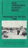
  • Here are the details of maps for Newbiggin:

  • Northumberland Sheet 65.10 Newbiggin by the Sea 1896 - published 1993; intro by Bill Harrison. ISBN.978-0-85054-550-1

    This detailed map covers the small Northumbrian fishing village and seaside resort of Newbiggin. "Every weekend people from surrounding mining villages walked or travelled by horse and trap or train to the village to enjoy a pleasant day by the sea", as Bill Harrison tells us in his introduction.

    Features include the village centre with individual buildings neatly shown, railway station, St Bartholomew's church on the headland, Old Coble Inn, Old Ship Hotel, Queen's Head, lifeboat house, Woodhorn Demesne, etc.

    On the reverse we include extracts from a contemporary trade directory plus Inch to the Mile sheet 10, revised 1902, which covers the village.


  • Follow this link for a complete list of our Northumberland maps.
  • You can order maps direct from our On-line Mapshop. For other information and prices, and other areas, go to The Index Page.
  • Maps in the Godfrey Edition are taken from the 25 inch to the mile map and reduced to about 15 inches to the mile. For a full list of maps for the North East, return to the North East page.
    The Godfrey Edition / sales@alangodfreymaps.co.uk / 15 January 2018