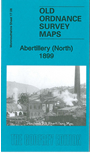
Monmouthshire Sheet 17.08 Abertillery (North) 1899 - published 2014; intro by Ray Lawrence. ISBN.978-1-84784-824-6
This detailed map covers the northern part of Abertillery.
Features include Rose Heyworth Colliery, Newtown, GWR Western Valleys line, Coed Castellau, Pen-y-Bont, Tillery Pit, southern part of Cwmtillery,
Rhiw-Park, Gray Pit, Pullinger's Coal Level, Tillery Coal Level, mineral tramway, chapel and schools, etc. Extracts from a directory are included on the reverse.
The map links up with sheet 17.12 Abertillery South to the south.
Follow this link for a complete list of our Monmouthshire Series maps.
You can order maps direct from our On-line Mapshop.
For other information and prices, and other areas, go to The Index Page.
Maps in the Godfrey Edition are taken from the 25 inch to the mile map and reduced to about 15 inches to the mile.
For a full list of maps for Wales, return to the Wales page.
The Godfrey Edition / sales@alangodfreymaps.co.uk/A> / 21 November 2017
 This is our map for north Abertillery: