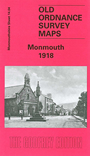
 Here are details of our map for Monmouth:
The historic county town, Monmouth is an attractive town well known for its association with Henry V, who was born here, and Geoffrey of Monmouth, one of the greatest of medieval authors. In the 19th century it was also the town with the highest proportion of pubs per resident - in 1901 it had 61 pubs for just 5,095 people! Our detailed map covers most of the town, and features include St Mary's church, Monnow Street, Castle remains, Priory Mill, Grammar School, Cattle Market, Troy station, May Hill station, Trothy Bridge (near foot of map), Victoria Estate, Over Monnow, St James church, Brook Estate, Chippenham, St Thomas Square, Drybridge, Monnow Bridge, Wye Bridge etc. We include directory extracts on the reverse, listing private residents, plus 1906 railway timetables for the Coleford-Monmouth-Chepstow and Ross-Monmouth-Pontypool lines.