Old Ordnance Survey Maps of Monmouthshire

  • These detailed maps normally cover an area of about one and a half miles by one mile. Each map includes an introduction.
  • They are available through our On-line Mapshop

  • Here are the details of maps for Tredegar (N):

  • Monmouthshire Sheet 11.09 Tredegar (North) 1899 - published 2012; intro by Derrick Pratt. ISBN.978-1-84784-640-2

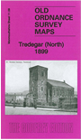
    This very detailed map covers the northern part of Tredegar, including Sirhowy. Coverage stretches from Dukestown and St Luke's church southward to Commercial Road.

    Features include north part of Tredegar Iron Works, Gelli Cottages, St George's church, Beaufort Row, Sirhowy area, Sirhowy Inn, The Four Rows, Dukestown area, Scwrfa area, LNWR Sirhowy Branch with Sirhowy station, numerous mineral lines, old coal pits, old quarries, coke ovens etc. A 1906 commercial directory of Tredegar is included on the reverse.

    The map links up with sheet 11.10 Ebbw Vale N to the east, 11.13 Tredegar S to the south.


  • Follow this link for a complete list of our Monmouthshire Series maps.
  • You can order maps direct from our On-line Mapshop. For other information and prices, and other areas, go to The Index Page.
  • Maps in the Godfrey Edition are taken from the 25 inch to the mile map and reduced to about 15 inches to the mile. For a full list of maps for Wales, return to the Wales page.
    The Godfrey Edition / sales@alangodfreymaps.co.uk/A> / 21 November 2017