
 Here are the details of maps for Hatton:

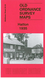
This detailed map covers an area just east of Heathrow, from Hatton village northward to Berkeley Avenue at Cranford.
Features on this map include Hatton Farm, St Anthony's Home, Dog & Partridge inn, Hatton Road Farm, River Crane, isolation hospital, Byron Avenue area. Most of the area west of the River Crane has today been covered with Heathrow infrastructure. On the reverse we include 1933 directories for East Bedfont, Hatton and Cranford.
The map links up with Middlesex Sheets 19.08 Heathrow to the west, 20.01 Harlington to the north, 20.06 Hounslow West to the east and 20.09 North Feltham to the south.
 Follow this link for a list of our maps for the London Borough of Hillingdon, or here for a complete list of our London maps .