
 Here are the details of maps for Sipson:

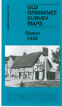
This detailed map covers an area which in 2008 is once again under threat from plans to extend Heathrow Airport. The map covers Sipson, Sipson Green, and the area around The Magpies pubs. Features include the west end of General Roy's Base, Sipson House, Magpies pub, Sipson Farm, Sipson Lane, but the area was still largely of villages on the Bath Road. We also include the Harmondsworth entry from a 1933 directory.
The map links up with Middlesex Sheets 14.16 West Drayton to the north, 19.03 Harmondsworth to the west, 19.08 Heathrow to the south, 20.01 Harlington to the south..
 Follow this link for a list of our maps for the London Borough of Hillingdon, or here for a complete list of our London maps .