
 Here are the details of maps for Hanger Hill & Park Royal:

We have published two versions of this map, showing how the area changed across the years.
The 1895 version is a somewhat empty map showing just how rural much of Middlesex was at the end of the 19th century, even though it includes parts of Ealing, Willesden, Acton and Hanwell parishes, and is only a mile from the great railway interchange at Willesden Junction. Features include Hanger Hill and a handful of large houses along Hanger Lane, the Grand Junction Water Works, Twyford Abbey, and several farms. By contrast, the 1935 version is filled with industry, including the western half of the Park Royal estate. A fascinating contrast.
The map links up with Middlesex sheet 16.01 Alperton to the north; and London Sheets 45 Perivale to the west, 46 Willesden Jct to the east, and 57 Acton Town to the south.
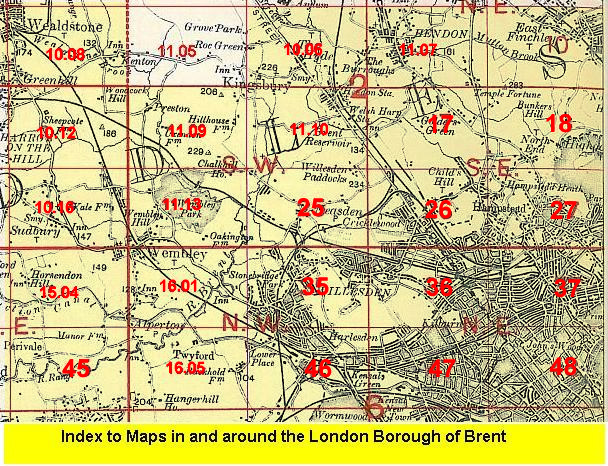 Follow this link for a list of our maps for the London Borough of Brent, or here for a complete list of our London maps .