
 Here are the details of maps for Hayes Town:

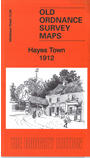
This detailed map covers the area of Hayes known as Hayes Town, now part of Hillingdon Borough.
Features includes Hayes Town village with St Mary's church, Manor Lodge, Court Farm, Wood End, Barra Hall, Rectory Farm, Botwell House (at foot of map), The Lake, White Hall, Coldharbour Farm, Jewish Boys Industrial School, High Road and tramway, Park Farm etc. A small portion of the Grand Junction Canal is in the SW corner. We include an 1890 directory of Hayes on the reverse.
The map links up with Middlesex Sheets 14.12 Yiewsley to the west, 15.05 Hayes End to the north, 15.10 Southall to the east, 15.13 Hayes South to the south.
 Follow this link for a list of our maps for the London Borough of Hillingdon, or here for a complete list of our London maps .