
 Here are the details of maps for Kenton & Wealdstone:

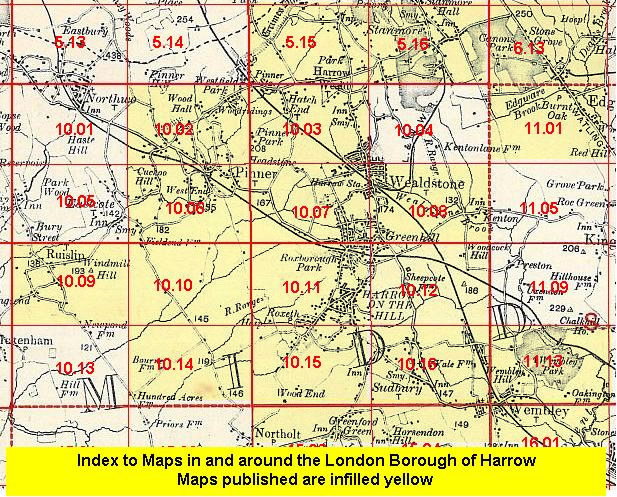
We have published just the one version of this map. The map covers an area stretching from Harrow & Wealdstone station eastward to Kenton, and from Peel Road southward to Kenton station. Wealdstone and a small portion of Harrow are at the left of the map, while Kenton, here just a handful of buildings, is to the right; the area in the centre, including around Kenton station, is still countryside. The Wealdstone Brook, Kenton Road and Kenton Lane run through the map. Other features include Greenhill, part of the Stanmore Branch railway, Dirty Lane, Station Road, and two sewage farms. There are street directories for Masons Avenue, Peel Rd, Rosslyn Crescent and Station Road on the reverse.
The maps links up with sheet 10.07 North Harrow to the west, 10.12 South Kenton to the south.
An index map showing the areas covered by this map may be added at a later stage.
 Follow this link for a list of our maps for the London Borough of Harrow, or here for a complete list of our London maps .