
 Here are the details of maps for Harefield:

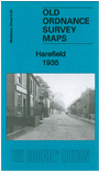
This detailed map covers the village of Harefield, straddling the border between Middlesex and Hertfordshire (though the small portion of Buckinghamshire is left blank).
Features include village centre with individual buildings neatly shown, The Green, Harefield House, Sanatorium, Mount Pleasant, Manor Court, Harefield Mills, River Colne, Grand Union Canal, etc. On the reverse we include directory entries, listing inhabitants for 1890 and 1933.
 Follow this link for a list of our maps for the London Borough of Hillingdon, or here for a complete list of our London maps .