
 Here are the details of the map for the Homerton area:

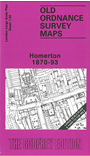
This highly detailed map at a 'Yard to the Mile' scale covers central Homerton, east of Hackney; coverage stretches from Homerton Terrace eastward to Sidney Road. The High Street runs through the map and the map is so detailed that even some garden layouts are shown. Also shown in great detail are Hackney Union Workhouse, St Barnabas church, Homerton station, Ram's Chapel, East London Union Workhouse, Homerton College, Gravel Pit Chapel Mission Rooms, all including some interior layout detail. On the reverse we include the 1893 map for the same area, now with Eastern Fever Hospitals.
The map links up with Sheet 7.09 Central Hackney to the west.