Old Ordnance Survey Maps of Lanarkshire

  • These detailed maps normally cover an area of about one and a half miles by one mile. Each map includes an introduction.
  • They are available through our On-line Mapshop

  • Here are the details of maps for Motherwell:

  • Lanarkshire Sheet 12.09 Motherwell (North) 1939 - published 2007; intro by Gilbert Bell. ISBN.978-1-84151-991-3

    This detailed map covers the area north of Motherwell, with coverage stretching along the Bellshill Road northward to Holm Forge Bridge. Features on the map include Motherwell Mill, Colville Park, Forgewood, railways with engine shed, site of earlier Jerviston Line, Nethan Iron Works, Wallace's Cave, course of Roman Road, Braidhurst Colliery, Parkneuk Works, Engineering Works, Parkneuk Colliery, North Motherwell. We include extracts from a trade directory on the reverse.


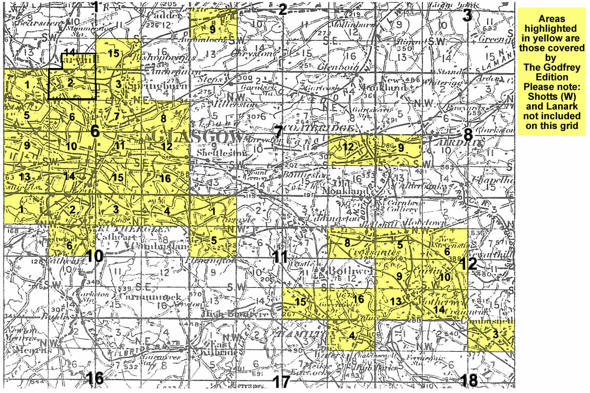
    You might find this index map useful. The map links up with Sheets 12.05 Mossend to the north, 12.10 Carfin to the east, 12.13 Motherwell to the south.


  • Follow this link for a complete list of our Glasgow or Lanarkshire maps.
  • You can order maps direct from our On-line Mapshop. For other information and prices, and other areas, go to The Index Page.
  • Maps in the Godfrey Edition are taken from the 25 inch to the mile map and reduced to about 15 inches to the mile. For a full list of maps for Scotland, return to the Scotland page.
    The Godfrey Edition / sales@alangodfreymaps.co.uk / 11 November 2016