Old Ordnance Survey Maps of Lanarkshire

  • These detailed maps normally cover an area of about one and a half miles by one mile. Each map includes an introduction.
  • They are available through our On-line Mapshop

  • Here are the details of maps for Airdrie:

  • Lanarkshire Sheet 8.06 Airdrie (North) 1897 - published 2014; intro by Gilbert Bell. ISBN.978-1-84784-856-7

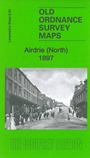
    This very detailed map covers the northern part of Airdrie, with coverage from South Bridge St northward to St Joseph's RC Cemetery and eastward to Colliertree.

    Features include parts of Clarkston and Drumgelloch, Rawyards, Drumbathie, Easter Mavisbank, Ballochney Incline, Rawyards station, NBR Slamannan Section, NBR Brownieside Branch, Monkland Branch, small part of Thrashbush incline, North Bridge, Rawyards House.

    The map links up with sheet 8.10 Airdrie South to the south.


  • Follow this link for a complete list of our Glasgow or Lanarkshire maps.
  • You can order maps direct from our On-line Mapshop. For other information and prices, and other areas, go to The Index Page.
  • Maps in the Godfrey Edition are taken from the 25 inch to the mile map and reduced to about 15 inches to the mile. For a full list of maps for Scotland, return to the Scotland page.
    The Godfrey Edition / sales@alangodfreymaps.co.uk / 11 November 2016