Old Ordnance Survey Maps of Lanarkshire

  • These detailed maps normally cover an area of about one and a half miles by one mile. Each map includes an introduction.
  • They are available through our On-line Mapshop

  • Here are the details of maps for Lenzie:

  • Lanarkshire Sheet 2.09 Lenzie 1897 - published 1994; intro by Don Martin. ISBN.978-0-85054-697-2

    This detailed map covers the village of Lenzie, south of Kirkintilloch. Coverage stretches from Garngaber (in the top right corner) southward to Auchinloch and westward to Mid Boghead. Features include the village around the station, Millersneuk House, Claddens House, East Gadloch, but most of the area outside the village is open country. On the reverse we include a section of Dumbartonshire sheet 33.06, which extends coverage north to Easter Gallowhill, and includes Woodilee Colliery its 1 and 2, with mineral lines.


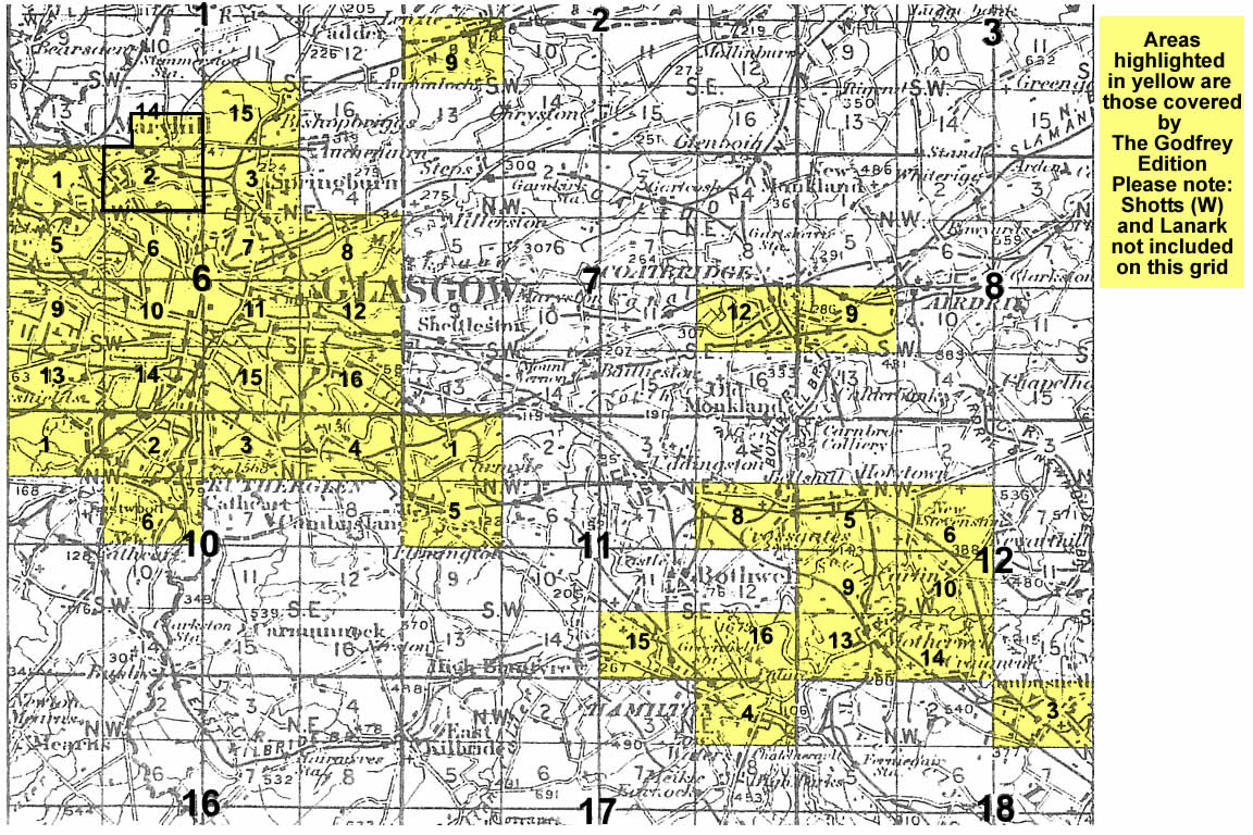
    You might find this index map useful. The map links up with Dumbartonshire sheet 33.02 Kirkintilloch to the north.


  • Follow this link for a complete list of our Glasgow or Lanarkshire maps.
  • You can order maps direct from our On-line Mapshop. For other information and prices, and other areas, go to The Index Page.
  • Maps in the Godfrey Edition are taken from the 25 inch to the mile map and reduced to about 15 inches to the mile. For a full list of maps for Scotland, return to the Scotland page.
    The Godfrey Edition / sales@alangodfreymaps.co.uk / 11 November 2016