Old Ordnance Survey Maps of Leeds


  • For the central area of Leeds we have reprinted some of the very early Five-foot plans. Originally published at a scale of 1:1056 or 5 feet to the mile, we have reduced them in scale to 1:1760 or a Yard to the Mile. The maps, though covering quite a small area, are wonderfully detailed, showing such features as capstans and mooring posts, lamp-posts, the layouts of back yards, and even the interior of certain buildings such as churches. For the urban historian they are perhaps the most fascinating maps ever published by the Ordnance Survey.
  • Each map includes a specially written introduction to the area. Maps can be purchased on our On-line Mapshop where further information about titles is given.

  • Here are the details of maps for Leeds (Town Hall area):

  • Leeds 10 Leeds (Town Hall & Park Square) 1847-63 - published 2006; intro by G C Dickinson. ISBN.978-1-84151-854-1

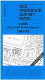
    This wonderfully detailed map covers the area around Park Square, with coverage stretching from Hanover Square eastward to Park Row and southward to Wellington Street. Surveyed in 1847, the map is updated to 1863 for some details, notably the Town Hall. Features include the Town Hall (including interior), Leeds Infirmary, Mixed Cloth Hall, Mechanics Institute, Baptist Chapel, East Parade Chapel, Philosophical Hall, Oxford Place Chapel, St Paul's church, Methodist Chapel, St George's church, St Philip's church, Bethesda Chapel. Most of these are shown in detail. Streets include Park Lane, West Street, Great George's Street. Where appropriate, turnpike trusts are named. On the reverse we include a selection of street directory entries, including those for Park Lane, Park Row, Park Square, Wellington Street, West Street.

    The map links up with Sheets 11 Leeds Headrow to the east and 14 Leeds Stations to the south.


  • Follow this link for a complete list of our Leeds Series maps.
  • You can order maps direct from our On-line Mapshop. For other information and prices, and other areas, go to The Index Page.
  • This map is taken from the OS '60 Inches to the Mile' map and reduced to a scale of '36 Inches to the Mile' For a full list of maps for England, return to the England page.
    Alan Godfrey Maps, Prospect Business Park, Leadgate, Consett, Co Durham, DH8 7PW / sales@alangodfreymaps.co.uk / 23 January 2018