
 Here are the details of maps for Bardsley:

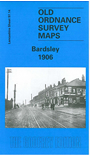
This very detailed map covers Bardsley, between Oldham and Ashton. The Oldham Road runs north-south through the centre of the map, incl Bardsley village with Wood Park Colliery, Holy Trinity church, Bardsley Colliery (disused), Wheatfield Iron Works, Bell Mill and Boundary Mill. Further east are Wester Hill and Lower Alt Hill, with a stretch of the Oldham & Guide Bridge railway, incl Park Bridge station. Further west are Knott Lanes, Wood Park and (top left of map) Hollins. Directories of Bardsley and Little Moss are included on the reverse.
The map links up with sheets 97.10 Oldham South to the north, 97.13 Failsworth to the west, 105.02 Daisy Nook to the south.